 ar
ar bg
bg hr
hr cs
cs da
da nl
nl fi
fi fr
fr de
de el
el hi
hi it
it ko
ko no
no pl
pl pt
pt ro
ro ru
ru es
es sv
sv tl
tl iw
iw id
id lv
lv lt
lt sr
sr sk
sk sl
sl uk
uk vi
vi et
et hu
hu th
th tr
tr fa
fa ms
ms hy
hy ka
ka ur
ur bn
bn mn
mn ta
ta kk
kk uz
uz ku
ku
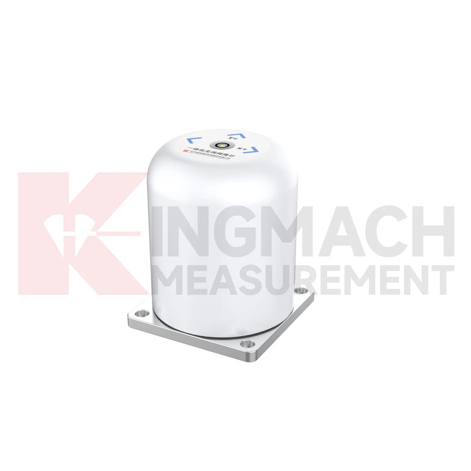
Biaxial Inclinometer
Kingmach Biaxial Inclinometer use different communication paths for different field needs. JMQJ-7315ADS uses RS485 digital output and works well in wired automated systems. JMQJ-7315RTU uses wireless 4G digital output and is better suited to sites where cables are difficult to run or where remote unattended measurement is expected. JMZX-7100L uses Bluetooth for mobile field reading and can store large amounts of inclinometer data for later analysis. JMQJ-7915ATS and JMZX-4QH support downhole multi-point data collection through grouped communication and acquisition modules. Communication planning should define cable route, antenna position, cabinet protection, baud rate, channel address, sampling interval, power mode, and fallback manual check method. The communication method is part of measurement quality because lost data, wrong channel names, or unstable power can confuse the tilt trend.

Application of Biaxial Inclinometer
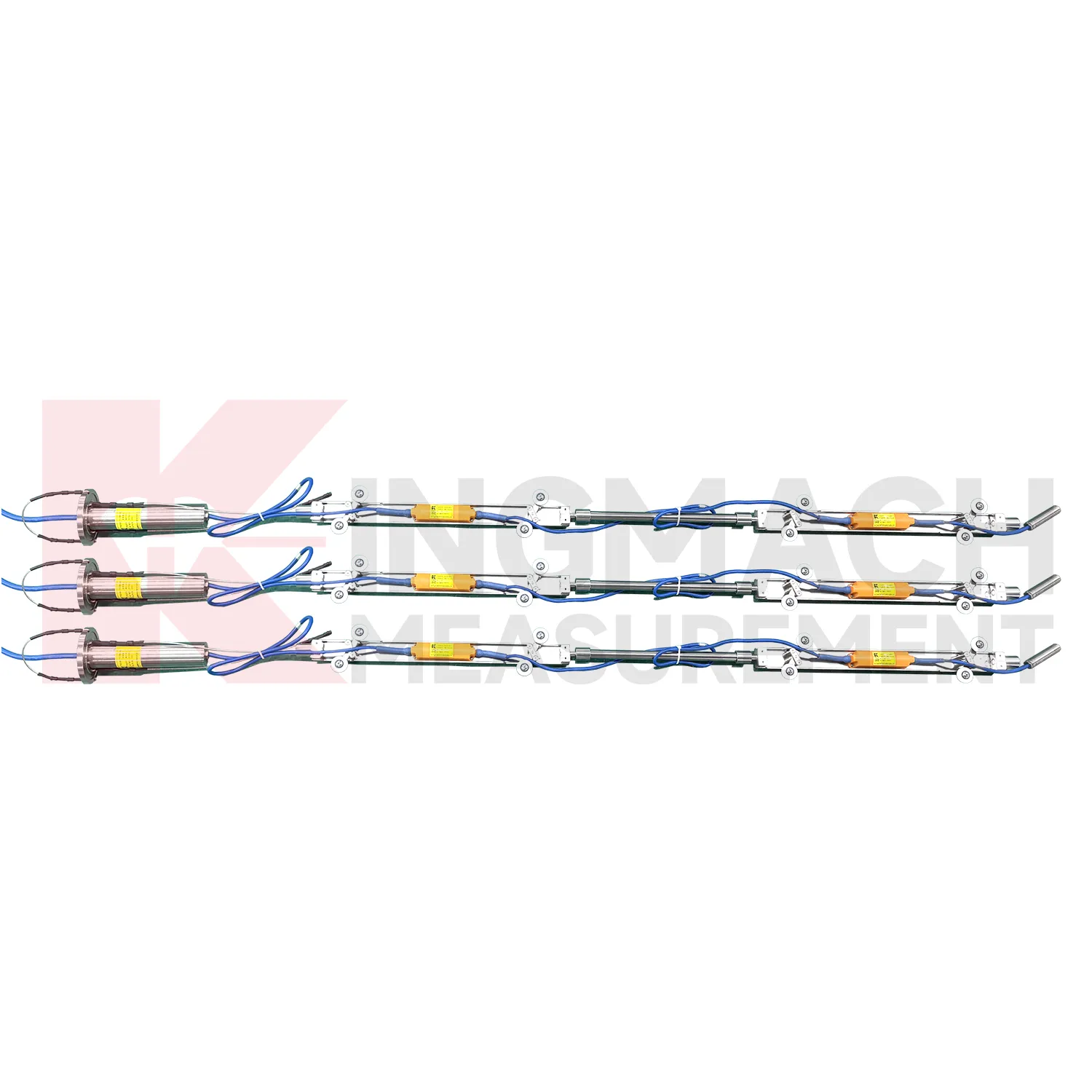
Slope and geological hazard monitoring use Biaxial Inclinometer to detect internal movement before the surface condition becomes clear. JMQJ-7915ATS is especially relevant because its multi-point in-place inclinometer string can observe deformation at different depths inside a borehole. JMZX-7100L can also be used for sliding inclinometer profiling in geotechnical slopes, dams, embankment slopes, and port engineering. Slope tilt or inclinometer data should be read with rainfall, groundwater, crack width, surface displacement, retaining structure movement, and construction disturbance. The key question is often depth: is the movement shallow, deep, or concentrated along one weak layer? A borehole profile with consistent point naming and stable orientation gives engineers better evidence for warning, inspection, and stabilization planning.
The future of Biaxial Inclinometer
Manual and automated methods will continue to coexist in future Biaxial Inclinometer programs. JMZX-7100L supports APP reading, Bluetooth transmission, large storage, data download, and post-processing software for sliding inclinometer surveys. Fixed products such as JMQJ-7315ADS and JMQJ-7315RTU support automated structural tilt monitoring. In practice, a site may need both. Automated sensors can watch key points continuously, while manual inclinometer profiling can confirm deeper deformation at scheduled intervals. Future monitoring plans should define how manual profiles and automated curves are compared, who reviews differences, and how field notes are stored. This mixed approach is useful in slopes, ports, foundation pits, dams, and underground works where access and risk change over time.
Care & Maintenance of Biaxial Inclinometer
Sliding inclinometer care for Biaxial Inclinometer requires consistent field procedure. JMZX-7100L uses a sliding probe with Bluetooth communication, APP reading, storage, and post-processing software. Field crews should use the same casing reference, probe orientation, depth interval, reading direction, and waiting time. Clean the probe after use, inspect guide wheels, check battery or reader status, confirm Bluetooth pairing, and download data before leaving the site. Record operator, weather, groundwater condition, casing obstruction, and any unusual resistance during movement. Small handling differences can create profile differences, so repeatability matters as much as instrument precision. Good manual practice keeps inclinometer profiles useful for comparing long-term soil movement.
Kingmach Biaxial Inclinometer
Kingmach Biaxial Inclinometer support both surface structural tilt monitoring and deep internal deformation monitoring. Surface tilt instruments measure the angular change of buildings, bridges, railways, towers, walls, and equipment bases relative to the horizontal plane. Deep inclinometer systems, by contrast, follow angle changes inside soil or structural bodies through a borehole. The JMQJ-7915ATS vertical in-place inclinometer system uses a multi-array MEMS design, universal joints, connecting rods, and an orifice acquisition module to collect multi-point readings. This gives engineers a depth profile rather than one surface reading. That distinction is important in slopes, dams, embankments, foundation pits, and underground works. A surface point may remain calm while a deeper layer starts moving. Using the right tilt method makes the deformation pattern easier to locate.
FAQ
Q: How accurate is the JMQJ-7315ADS tiltmeter?
A: The product page lists 0.001 degree resolution and 0.01 degree accuracy for the +/-15 degree dual-axis model.Q: What protection grade does JMQJ-7315ADS have?
A: It is listed with IP68 waterproof protection and an operating environment from -30 degrees Celsius to +80 degrees Celsius.Q: What range does JMQJ-7315RTU provide?
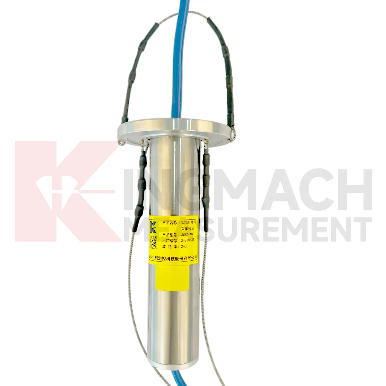
A: The integrated wireless model lists +/-30 degree and +/-15 degree dual-axis range options, with 0.001 resolution.Q: How many sensors can JMZX-4QH support?
A: The module lists four channels and support for up to 100 sensors in a multi-point inclinometer system.Q: What is the guide wheel spacing for JMZX-7100L?
A: The sliding inclinometer page lists a 500 mm guide wheel spacing reference and a +/-90 degree sensor range.
Reviews
Joshua Clark
We ordered a full monitoring solution including sensors and data loggers. Everything works seamlessly together. Great supplier!
Christopher Martinez
Very satisfied with the readouts & data loggers. User-friendly interface and supports multiple sensor inputs.
Latest Inquiries
To protect the privacy of our buyers, only public service email domains like Gmail, Yahoo, and MSN will be displayed. Additionally, only a limited portion of the inquiry content will be shown.
Emma***@gmail.comCanada
Dear Sir/Madam, we are interested in displacement transducers and settlement sensors for a geotechni...
Harper***@gmail.comIndia
Dear Sir, we are planning to procure a complete monitoring system including strain gauges, tiltmeter...