 ar
ar bg
bg hr
hr cs
cs da
da nl
nl fi
fi fr
fr de
de el
el hi
hi it
it ko
ko no
no pl
pl pt
pt ro
ro ru
ru es
es sv
sv tl
tl iw
iw id
id lv
lv lt
lt sr
sr sk
sk sl
sl uk
uk vi
vi et
et hu
hu th
th tr
tr fa
fa ms
ms hy
hy ka
ka ur
ur bn
bn mn
mn ta
ta kk
kk uz
uz ku
ku
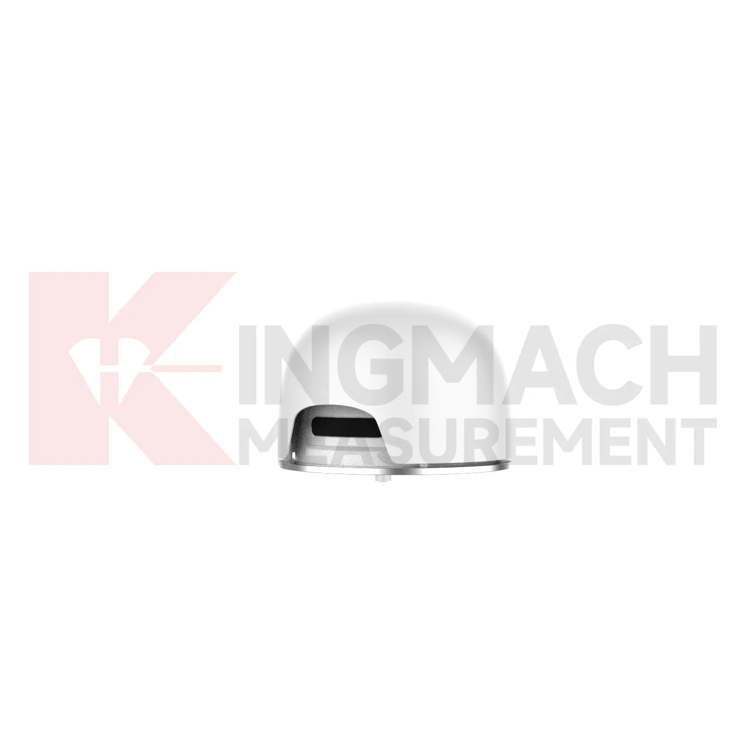
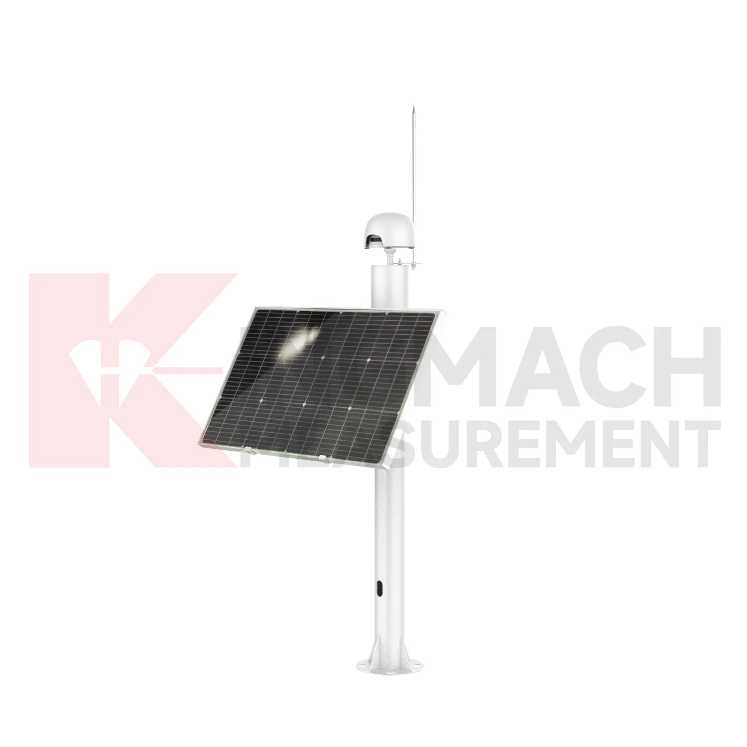
Integrated GNSS
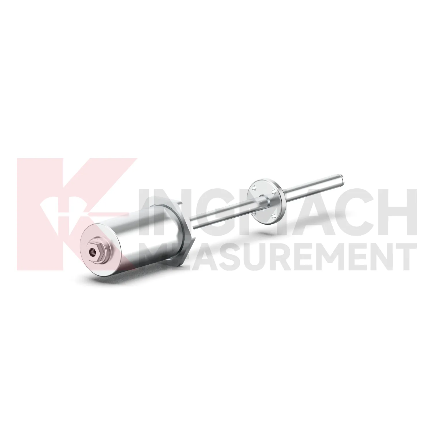
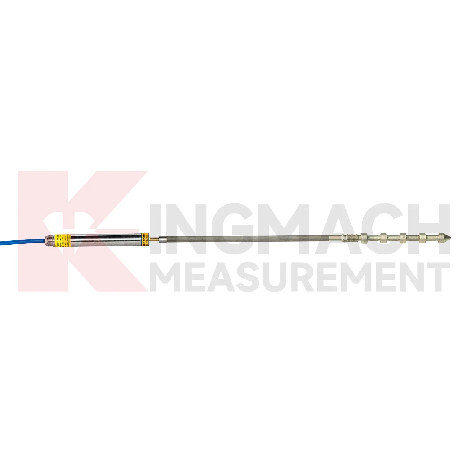
Kingmach Integrated GNSS cover a broad group of displacement measurement products for civil, geotechnical, hydropower, transportation, and industrial projects. The product category includes short-range crack gauges, general-purpose displacement meters, differential displacement meters, flexible geogrid meters, multipoint rock displacement meters, single-point bedrock meters, formwork displacement meters, wire rope sensors, magnetostrictive displacement meters, and GNSS displacement devices. This range matters because displacement measurement is not one mechanical condition. A bridge joint may need 20 mm to 100 mm differential monitoring, while a draw-wire application may require 500 mm to 2000 mm travel. Some projects need embedded anchoring and grouting, while others need surface brackets, universal bases, or a cable pulled between two points. Kingmach supports these different layouts with digital output, stored calibration data, waterproof structures, and automatic acquisition compatibility. The goal is to give engineers stable movement data that can be traced from sensor body to monitoring platform. During project setup, the measuring point should be matched with the expected travel direction, available mounting space, cable route, and required acquisition interval. This prevents a short-range joint instrument from being used on a long-travel point, or an exposed sensor from being placed where an embedded anchor is needed. It also helps the monitoring team set a baseline that can be defended during acceptance and later maintenance review.
Application of Integrated GNSS
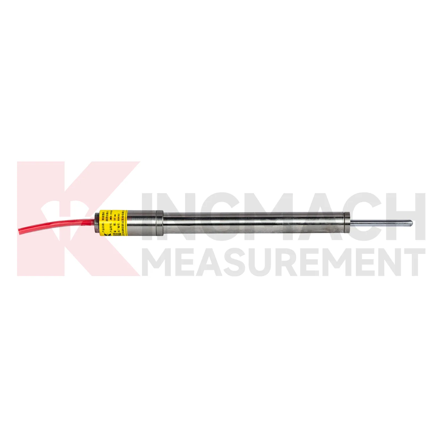
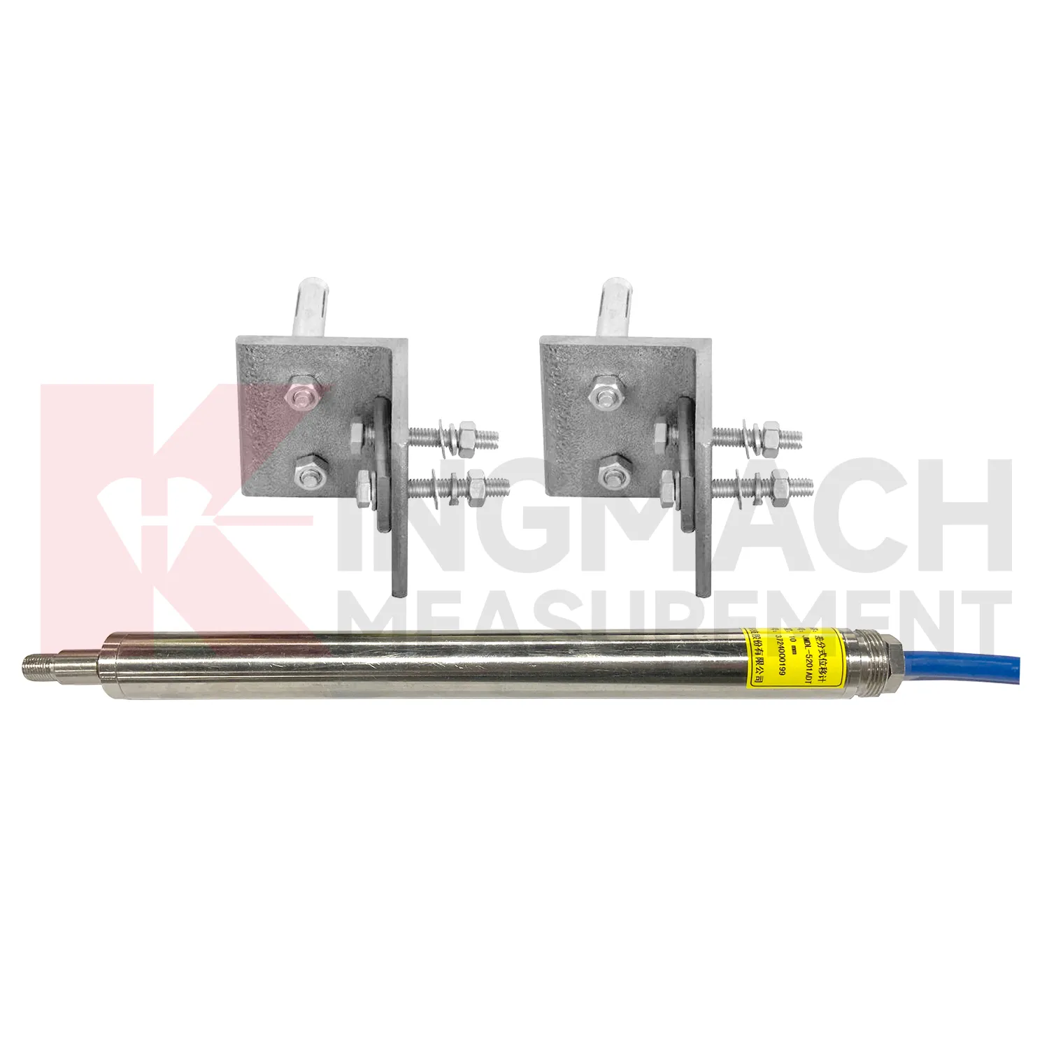
In dam and hydropower projects, Integrated GNSS can track joint opening, bedrock deformation, gate position, dam body movement, tunnel portal movement, and displacement between monitoring points. The pain point is long service life under water level fluctuation, seepage, temperature change, and difficult access. Kingmach JMDL-32XXAT single-point bedrock meters are designed for dam bedrock deformation and provide 50 mm, 100 mm, and 200 mm ranges with 0.01 mm resolution. JMDL-52XXADT differential meters can monitor relative movement in concrete joints with RS485 digital output and plus or minus 0.1%FS accuracy. JMCW-21XXADT magnetostrictive meters provide 0 to 1000 mm absolute position measurement for gates, equipment stroke, or structural movement. JMLS-22XXADT wire rope sensors support up to 2000 mm for larger displacement paths. Combined with water level, seepage, strain, and temperature monitoring, displacement data helps dam managers understand deformation behavior across operating cycles. During operation, the monitoring team should keep the baseline, temperature, inspection notes, and nearby sensor behavior in the same review file. This makes it easier to tell whether a movement trend comes from normal service, a repair event, changing load, water influence, or developing structural risk. Clear records also help owners decide when a field inspection is needed instead of waiting for visible damage.
The future of Integrated GNSS
The future of Integrated GNSS will put stronger emphasis on installation metadata. Many errors in displacement monitoring begin before the first reading: wrong range, poor bracket alignment, cable tension errors, unprotected connectors, zero readings taken during unstable loading, or channel names that do not match drawings. Kingmach smart displacement products store sensor data and measurement records, and future workflows can add digital installation forms, photos, QR codes, baseline checks, and automatic range verification. A field technician could scan the sensor, confirm whether it is a 50 mm, 100 mm, 200 mm, 1000 mm, or 2000 mm model, then bind it to the monitoring point. That small process improvement can prevent costly confusion months later, especially in projects with many cracks, joints, anchors, geogrid points, and rock-layer measurement depths. The strongest systems will still depend on careful installation, because digital tools cannot correct a loose bracket, wrong range, or poorly recorded baseline. Clear reporting will make displacement monitoring more useful for non-specialist decision makers while preserving the detail engineers need.
Care & Maintenance of Integrated GNSS
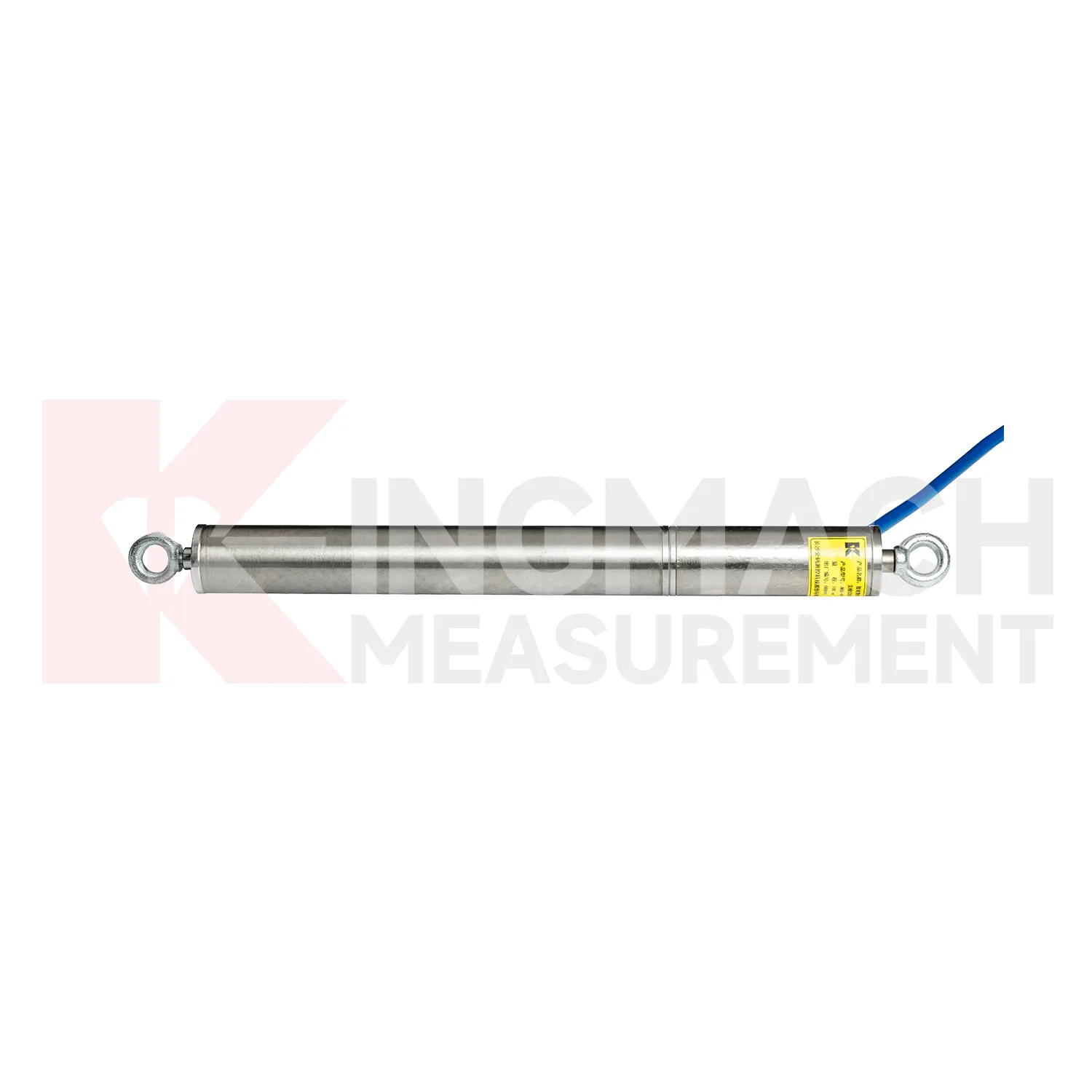
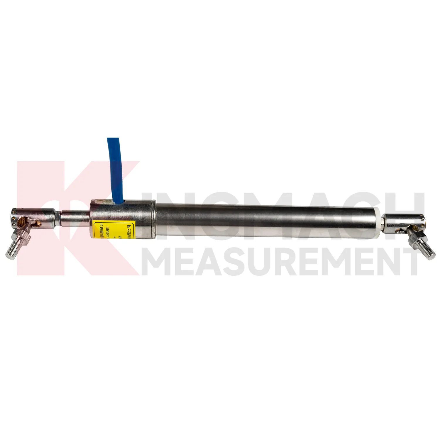
For differential Integrated GNSS, maintenance should preserve the geometry that makes high precision possible. Kingmach JMDL-52XXADT uses two coupled inductive coils to reduce environmental interference and thermal drift. The product lists 20 mm, 50 mm, and 100 mm ranges, 0.01 mm resolution, plus or minus 0.1%FS accuracy, RS485 output, low power consumption, and -40 degrees Celsius to +80 degrees Celsius operating temperature. During installation, align the measuring rod so it moves freely without side load or rubbing. Protect the device from impact at expansion joints and from water pooling around connectors. During service, compare readings across temperature cycles and confirm that movement returns as expected when the structure cools or unloads. A persistent offset may indicate structural change, bracket movement, or cable trouble. Keep yearly stability checks and calibration records with the monitoring database, not only in paper files. Keep the installation photo, point number, zero value, and expected movement direction with the commissioning record for later review. If a reading changes after maintenance work, inspect the base, anchor, cable, and cabinet before assuming the structure itself has moved.
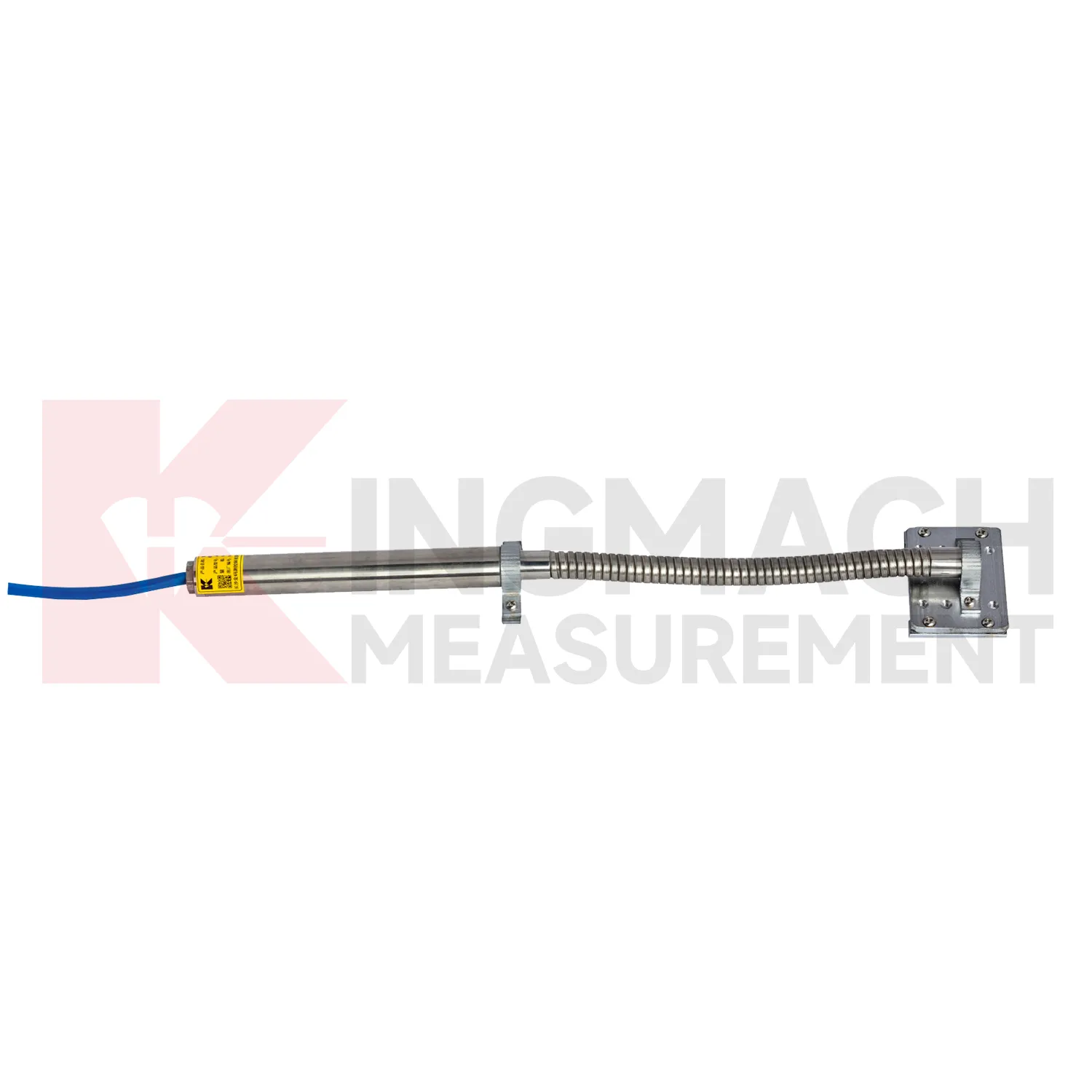
Kingmach Integrated GNSS
Integrated GNSS are used when a structure needs movement data that can be reviewed, compared, and acted on before deformation becomes visible. Kingmach covers short range crack movement, expansion joint travel, rock layer displacement, geogrid deformation, draw-wire movement, and long stroke position tracking. The category includes JMDL-21XXAT general-purpose displacement meters, JMDL-22XXAT crack gauges, JMDL-24XXAT flexible meters, JMDL-31XXAT multipoint meters, JMDL-32XXAT bedrock meters, JMDL-49XXAT formwork meters, JMDL-52XXADT differential meters, JMCW-21XXADT magnetostrictive meters, and JMLS-22XXADT wire rope sensors. On site, this means one product group can cover bridge joints, tunnel portals, slope movement, dam deformation, railway subgrade settlement, and industrial linear motion. The value is not only the displayed millimeter reading. It is the ability to connect movement, time, temperature, construction activity, and warning limits into one record. The point should be named on the drawing, linked with its cable route, and checked against the expected movement direction before the first automatic reading is accepted. For daily review, the reading should be compared with nearby points, recent weather, site operations, and any loading event that could explain the movement.
FAQ
Q: What are Integrated GNSS used for?
A: They measure movement such as relative displacement, crack width, expansion joint travel, bedrock deformation, rock layer movement, geogrid deformation, formwork settlement, and equipment stroke.
Q: Which Kingmach models belong to this category?
A: Common models include JMDL-21XXAT, JMDL-22XXAT, JMDL-24XXAT, JMDL-31XXAT, JMDL-32XXAT, JMDL-49XXAT, JMDL-52XXADT, JMCW-21XXADT, and JMLS-22XXADT.
Q: What range should be selected first?
A: Start from the expected movement. Short joint monitoring may need 20 mm to 100 mm, while draw-wire or equipment travel may require 500 mm to 2000 mm.
Q: Can these products support remote monitoring?
A: Yes. Several Kingmach models support digital transmission, RS485 communication, automatic acquisition, integrated testers, or unattended monitoring systems.
Q: Why is the baseline reading important?
A: All later movement is compared against the starting point. The baseline should be recorded after the sensor, bracket, anchor, cable, and structure are stable.
Reviews
David Wilson
We purchased displacement transducers and settlement sensors, and the quality exceeded our expectations. Easy installation and reliable performance.
Robert Taylor
The weir flow meter is well-built and delivers accurate measurements. Great value for water management applications.
Latest Inquiries
To protect the privacy of our buyers, only public service email domains like Gmail, Yahoo, and MSN will be displayed. Additionally, only a limited portion of the inquiry content will be shown.
Sophia***@gmail.comUnited Kingdom
Good day, we need environmental monitoring sensors including temperature, humidity, and wind sensors...
Isabella***@gmail.comGermany
Hello, we are evaluating weir flow meters for a water management project. Please share accuracy deta...
Related product categories
- displacement sensor
- laser displacement sensor
- displacement sensors
- linear displacement sensor
- optical displacement sensor
- wireless displacement sensor
- laser displacement sensors
- non contact displacement sensor
- cable displacement sensor
- draw wire displacement sensor
- inductive displacement sensor
- lvdt displacement sensor